Ask the city.
CityTwin turns the maps, open data and documents the city already has into a layer of urban intelligence you can query. Every answer comes with the sources it relies on and says openly where data is missing.
No account needed. It opens directly in your browser; the interface is in Romanian.
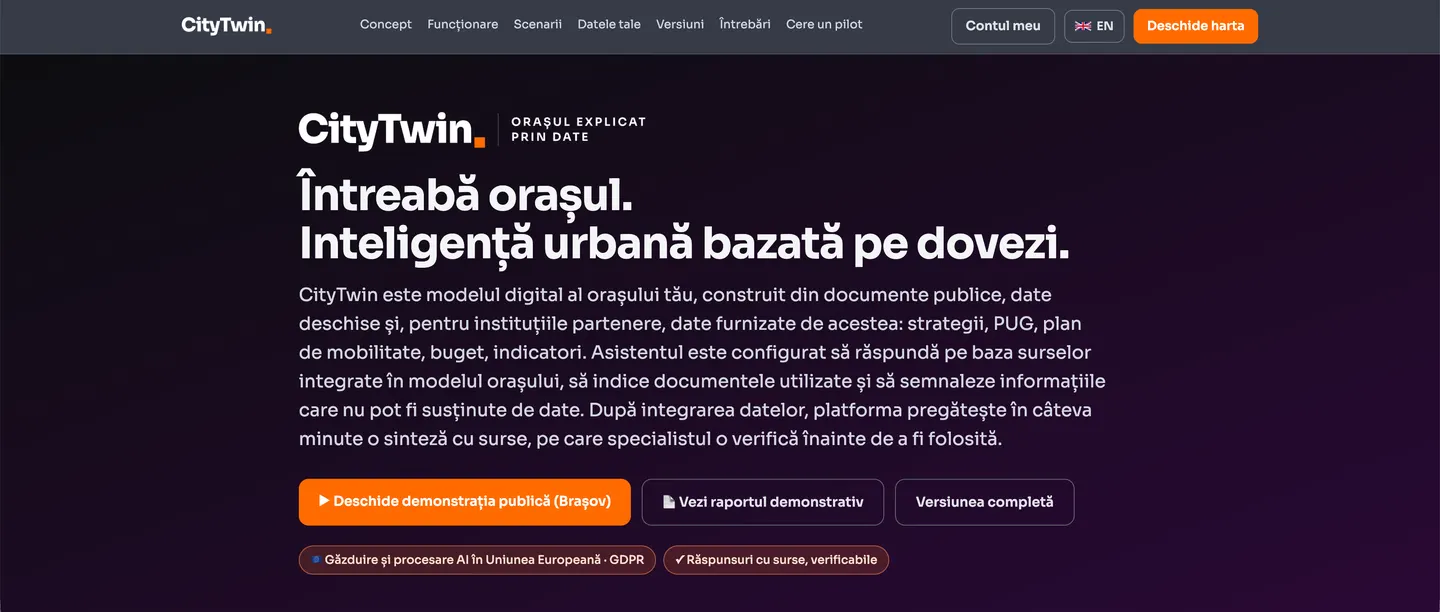
For cities that have nowhere to start.
An "enterprise" urban digital model needs sensors, 3D models, real-time infrastructure and a large technical team. In other words, exactly what a small or medium-sized Romanian city does not have. CityTwin builds the first intelligent layer on top of what already exists, and it can grow from there.
with real data
that can be simulated
mapped in OSM
under GDPR
What you see in the platform.
Screenshots from the public Brașov demonstration. Everything below can be opened and tried now.
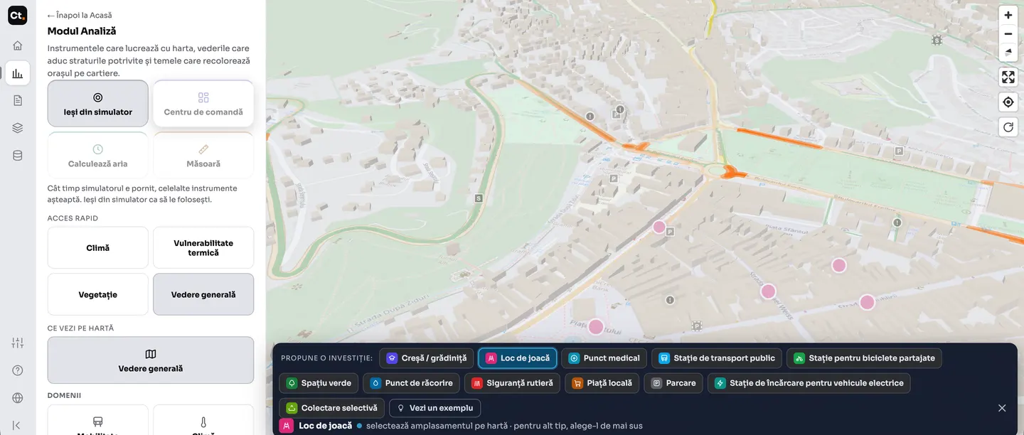
What changes if you put something there
You choose the type of investment (nursery, playground, medical point, transport stop, car park, charging station) and place it on the map. The effect is calculated on the real street network, not on a circle.
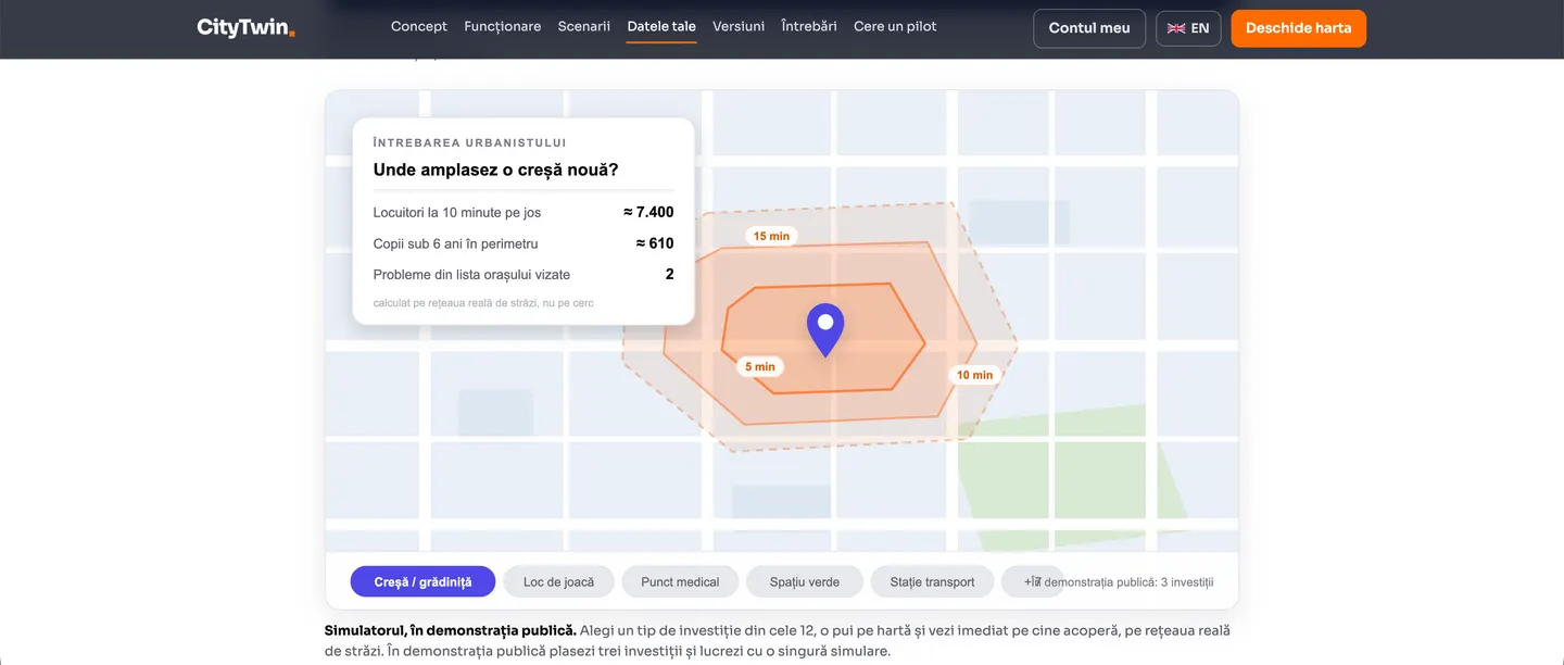
Who you reach, and in how long on foot
Isochrones of 5, 10 and 15 minutes on foot, with the residents and children under 6 within the area. In the public demonstration you place three investments and work with a single simulation.
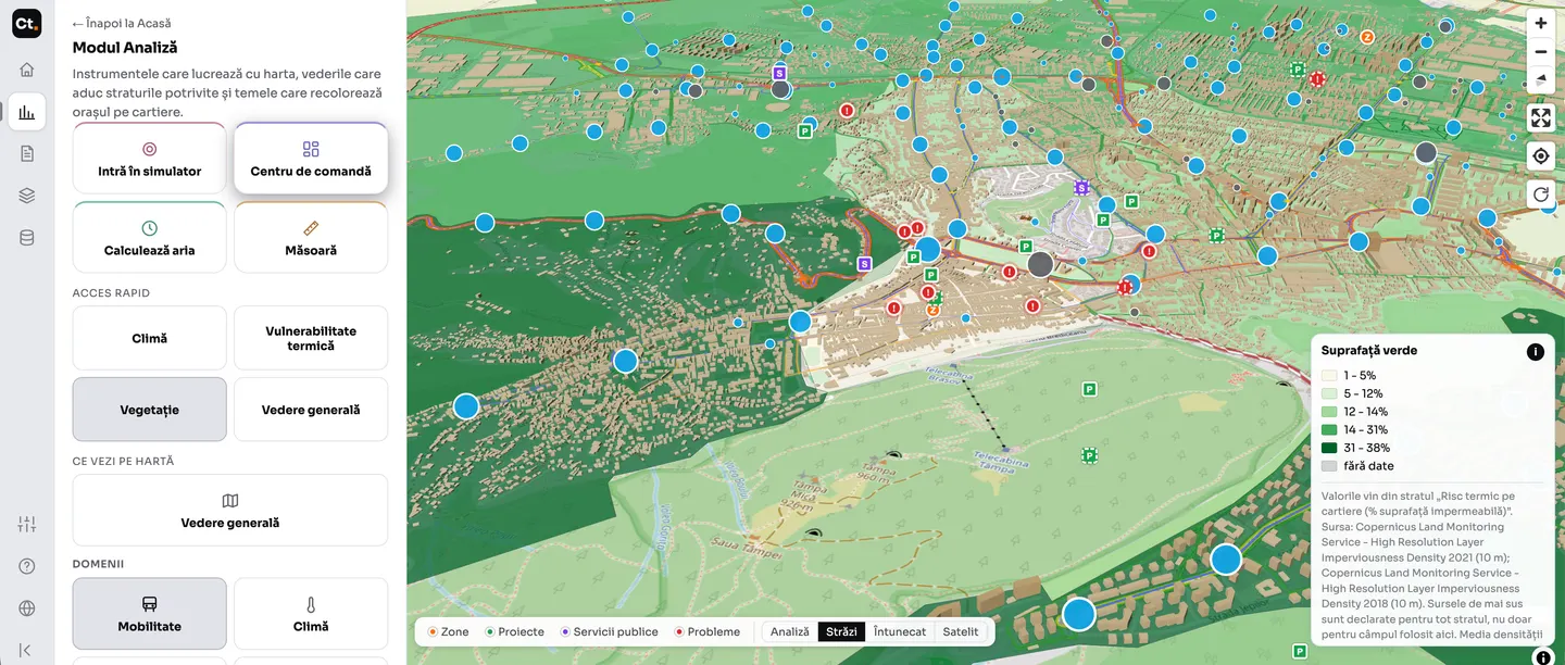
Thematic layers, in one click
Green space by neighbourhood, from the Copernicus imperviousness layer. Every layer states its source and year, and neighbourhoods without data are marked as such.
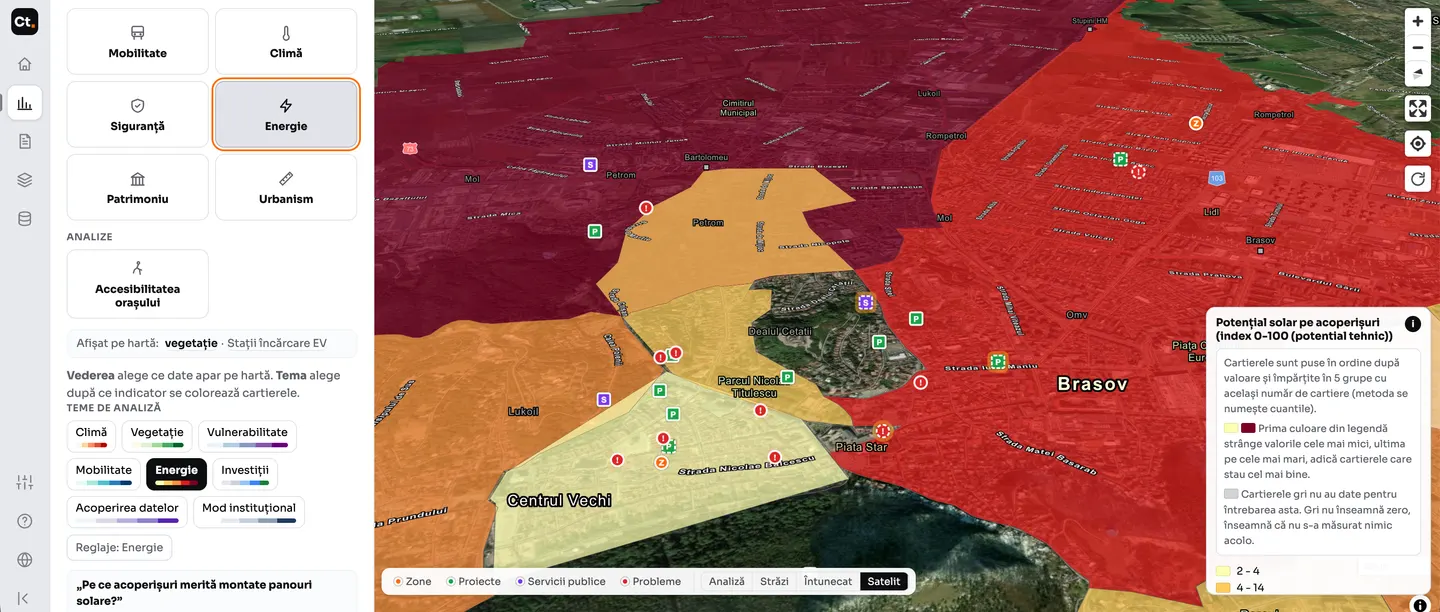
Which roofs are worth solar panels
Technical potential by neighbourhood, split into five groups with the same number of neighbourhoods. The legend says explicitly what the first colour means, so that it is not read as zero.
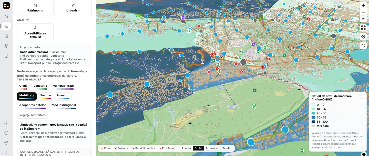
Where people struggle to reach a station
Estimated demand for charging stations, by neighbourhood. An estimated value, not a direct measurement: the platform says so in the legend, next to the source.
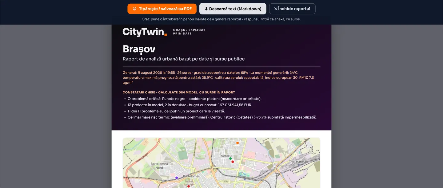
A decision report, ready to print
Findings calculated from the model, each with its sources: the critical problem, the projects under way with their known budget, the neighbourhood with the highest heat risk. It can be saved as PDF or text.
The data it works on.
Nothing invented. The documents and public data the city already has, plus open European sources.
The city's documents
Strategies, the general urban plan (PUG), mobility plans, the budget, indicators. Extracted from PDF and turned into a model.
OpenStreetMap
Streets, buildings, neighbourhoods, public services, heritage. Real geometries, under the ODbL licence.
European signals
Air quality from the CAMS service, climate and land cover data.
Local sensors and cameras
Particulate sensors and the city's public cameras, where they exist.
The full city model, the licences and the open schema can be downloaded from the platform in one click.
Where we stop.
CityTwin stops at diagnosis and at the evidence behind the decision. It shows where the problem is, on what data, and what changes if you intervene.
We do not design, we do not carry out works, we do not sell equipment and we do not replace the city hall's IT systems. The heat risk screen is stated to be a screening, not a specialist simulation, and the heritage layer is mapping from OpenStreetMap, not the official register. What comes after diagnosis (design, procurement, delivery) is the job of companies in the market.
A product developed by ARSC in its AI Studio.
Four products built by our own team, around concrete problems faced by local government. They stop at diagnosis, at the evidence behind a decision and at tracking the intervention; delivery is left to companies in the market.





Would you like CityTwin for your city?
We first show you the Brașov demonstration, then we discuss what data you have and what the first model of your community looks like.